Thursday 25 August 2011

Day 12 - 7/5/86 - South Stack to Rhosneigr

Distance: 28 km (18 miles)    Total Distance:    160 miles


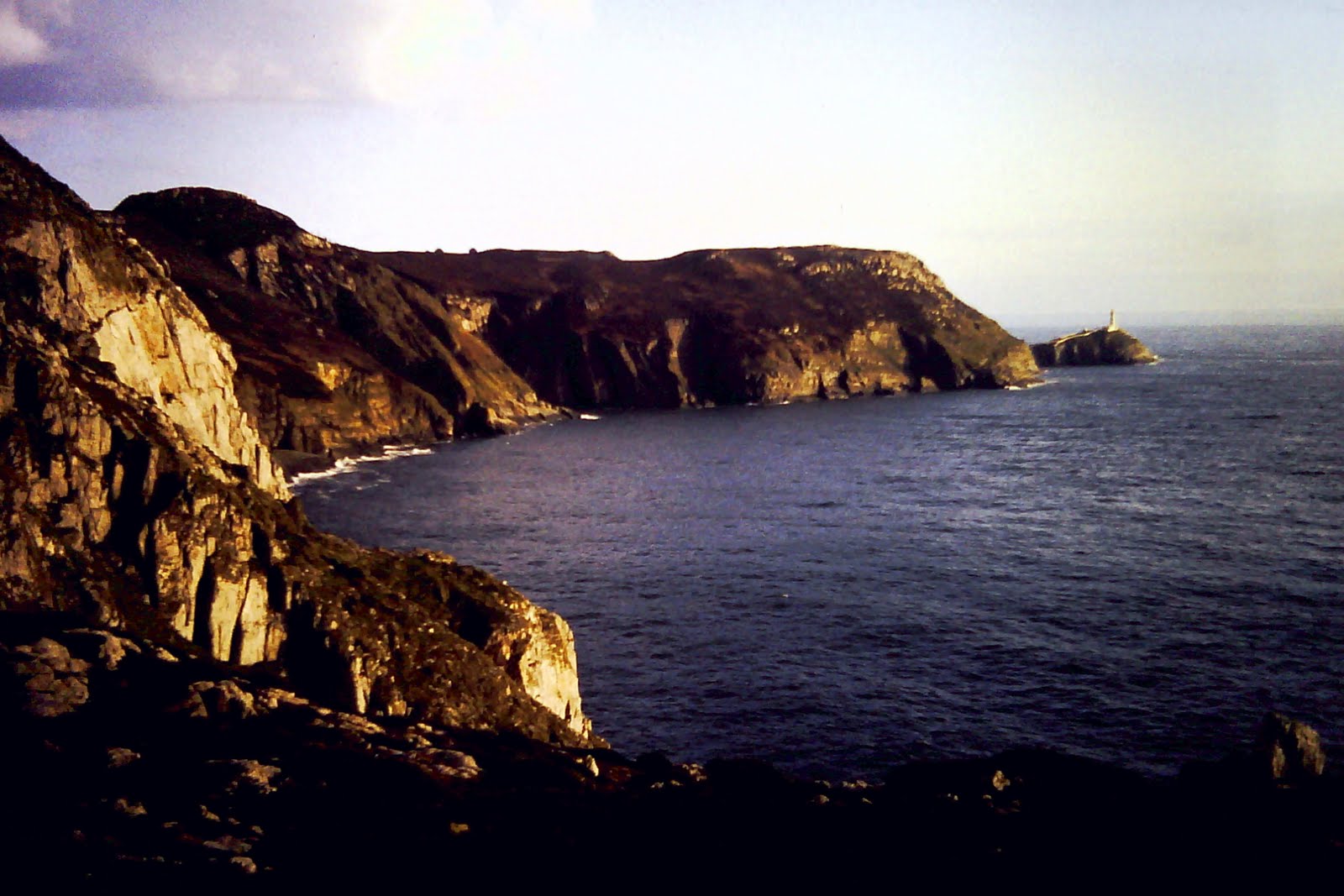
Today was another day of beautiful sunshine at the end of which I was feeling quite burnt on the face from the wind and the sun.  The path from South Stack to the south-west end of Holy Island was beautiful -  full of little bays and spectacular scenery.  Only Trearddur Bay showed any signs of being commercially spoilt.  A film crew was busy on one of the cliff tops. 

Porth Dafach


Porth Dafach - again - I liked this bit.


Porth Diana

Rhoscolyn Beacon from Rhoscolyn Head

It was impossible to walk the path beyond Borthwen Bay. Farmland with no footpaths and then a caravan site, which made it clear you were not supposed to go through it, blocked my way.  Instead it was a walk up the country lane and then a footpath veered off to the east.  The supposed path turned out to be very difficult walking especially along the muddy estuary front and through farms.  I was relieved to get to Four Mile Bridge where I had lunch – a packet of Jaffa Cakes and a pint of milk.


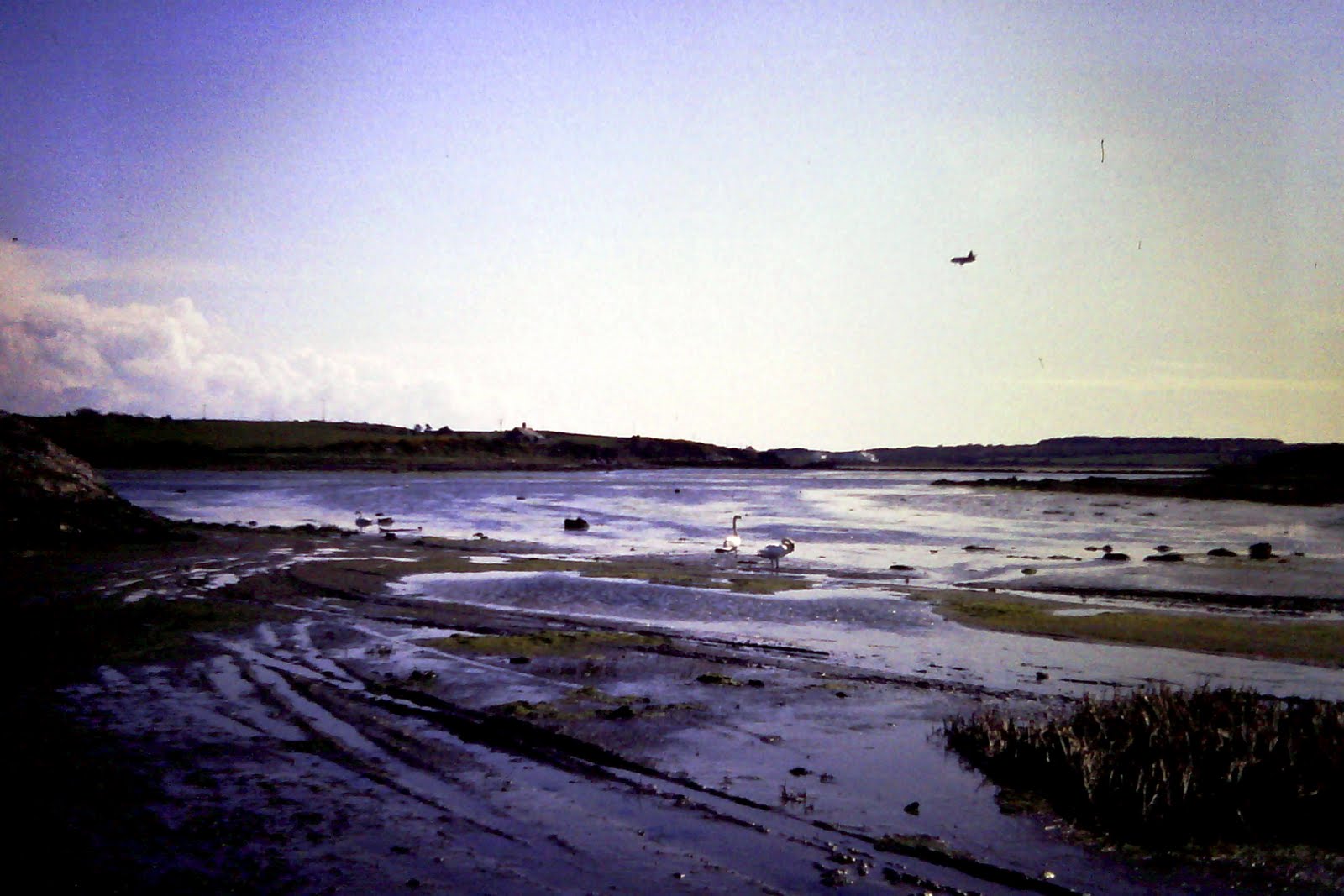
The ford near Llanfairynubwll


I thought the next bit may also be tricky but it was surprisingly easy.  By the time I got to the ford at Llanfaryneubwll the sound of planes at  RAF Valley was deafening – the Red Arrows were there practicing. The herons at the ford did not seem to mind the noise. The area was littered with fly tipped rubbish and judging by some of the correspondence it was someone from Valley and included empty bottles of sedatives. I was able to walk right by the end of the runway with planes only a couple of yards overhead – a spectacular view. 


Jets taining at RAF Valley - my free air show

It was then a long slog along the beach of soft sand at Rhosneigr.  I was pretty tired by so decided to call it a day and start hitching back to Holyhead.  I was relieved to get a lift in a van at the end of my walk up to the main road in Rhosneigr which took me up to the A5.  I then got a lift in a new Talbot van to Valley and finally a a strange lift into Holyhead.  I went to my aunt and uncles house.  They allowed me to have a bath - great when you've been walking for a few days, and then generously took me out for a great pizza.  I went back again to camp that night at Penrhyn.

Thursday 18 August 2011

Day 11 - 6/5/86 - Llanfaethlu to South Stack


Distance: 28 km (17 miles)    Total Distance:    142 miles


It was a disappointing start to the day's walking. I attempted to walk south along the coast from  Bothwen but soon got defeated by signs indicating ‘Private Land’ so had to come back up to the village of Llanfaethlu through country lanes and then back to the coast again at the sandy beach of Porth Tywyn-Mawr. A path at the other end of the beach took me through a caravan site.  It was another great day for walking – almost continuous sunshine with a good breeze to stay cool. 

It was particularly impressive walking up the estuary at Llanfachraeth where the Afon Alaw flows down to Traith y Gribin. There was so much bird life there, particularly swans.  Although there was a footpath marked on the map, much fence climbing was needed on the ground.  I stocked up on supplies and stamps Llanfachraeth Post Office and then some road walking was requited to reach Valley. 

I tried to cut through some fields over a marked footpath at SH304813, up the hill and back to the estuary. That was my plan anyway.  The field contained what I thought were two cows but as I got to the far end of the field they appeared rather large and had no udders!  One field led to another with no gate between only a gap.  I had to take refuge on top of the fence.  After ten minutes of trying to make friends with them I retraced my tracks deciding that venturing onwards was too dangerous.  I thought I had tamed them but just as I got back over the gate there was a thundering noise behind me. I looked round and saw the two bulls skidding to a halt after charging me! They were just behind the gate! 


After Valley, it was a long walk along the A5 over the Stanley Embankment, the bridge between Anglesey and Holy Island and another of Thomas Telford's designs.It's actually more of an embankment than a bridge because it is solid apart from a gap in the middle were the tide rushes in and out.   At the far end I passed the old toll-house before entering the nature reserve at Penrus. 

Good old Thomas - built to last!

On the other side of the A5 was the aluminium works. This produces aluminium by electrolysis of aluminium oer.  The factory is the largest consumer of electricity in the UK.   It was then along the promenade and into Holyhead. 

Holyhead harbour

Being a bit tired I thought the best plan was to hitch back to Llanfaethnu at this stage and set up camp.  I managed to get two lifts, one from a Jehovah’s Witness who worked at Anglesey Aluminium and one from an RAF man working at RAF Valley and someone else who had given up life in England to come to live in rural Wales.  I set up camp at Penthyn on a small farm and was pleased to find it had hot showers.  I didn't have any change to give the owner the £1 and he generously let me off and told me to give a donation to Greenpeace sometime.


I then went back to Holyhead and walked around the coast from North and South Stack.  Just as I was up on top of the vantage point of North Stack a spectacular storm came in over Holyhead.  I could see where my tent was and realised it was getting soaked.  Had I zipped up the doors I tried to remember?

That's my tent over there!

 
The paths over the Stack were not well marked and by the time I was on South Stack it was pouring with rain.  From there I had to walk all the way back to Holyhead along the lanes as I could not get a lift.  I called into my relatives to say hello and to say I would call back the following night.  I then went to have an curry in Holyhead and then back to camp.

The rocky west side of Holy Island looking south towards South Stack

South Stack - end of the days coastal walk - now just to get back to Holyhead!

Tuesday 26 April 2011

Day 10: 5/5/86 Amlwch to Llanfaethlu

Distance:  30.5km (19 miles)    Total Distance:   124 miles


I started walking at Amlwch harbour.  I found the town itself quite depressing with lots of run down estates.  I walked around the port but was foiled to keeping to the coast by a factory and had to cut quite a way inland.
Porth Leechog and a good bit of camera strap


The disused brick works at Porth Wen

After that the coastal path to Cames was excellent with spectacular bays both large and small.  I stopped in Cames to stock up. The local shop owner told me he felt guilty because he had never been to Cardiff.  I had a pint in the pub on the square and sat outside to watch the village life pass by.


I walked through the back end of town and through the fields to Wylfa power station. There were few people visiting the power station bearing in mind what had happened in Ukraine the previous week. The power station appeared amazingly peaceful but it was horrid to think what would happen if anything went wrong there.  It also appeared amazingly accessible to terrorists.

The path led by a couple of deserted farms and through beautiful gardens and past a stream at Porth-y-Pystyll. The sun shone all day and it made Cemlyn Bay look very good.  I walked on the seaward side of the causeway so as not to disturb the nesting birds on the freshwater side.


Porth-y-Pistyll

Cemlyn Bay

The public footpath disappeared at Camel Head whuch was a real shame as the sceenery was excellent. I eventually had enough of trespassing and having to climb over hedgerows every hundred yards which was not a good feeling, so after seeing the strange white concrete structures at Camel Head I cut inland. 
The Skerries from near to Camel Head - a beuatiful bit of coastline but without full access rights.

It took a couple of miles walking along roads to get back to the coast.  Looking down from Church Bay towards Holyhead was quite spectacular. 


Church Bay was full of surfers packing up after a Bank Holiday Weekends sport.  Even though there as an official path along the coast for the next bit though fields they were full of heffers but seemed to be harmless.  I decided to finish at Borthwein and walked up the hill to Llanfaethlu. 

Looking over to Holyhead from Pen-y-foel

Porth Trwyn- I was forced to walk inland again after this.

I had to walk for quite a while more to get a lift – it being Bank Holiday. I eventually got a lift from someone in a pick-up van whose business had gone bust in Stockport and now enjoyed his life on Anglesey doing part-time work in the restaurant in Borthwain. 

I camped another night at Red Wharf Bay.  I had picked up a Chinese take-away in Amlwch.  After putting up the tent I had a shower and went down the pub and got talking to some of the locals.  It was much emptier tonight as all the Bank-holidaymakers had gone home.

Tuesday 19 April 2011

Day 9: 4/5/86 Red Wharf to Amlwch

Distance:  24.5km (15.2 miles)    Total Distance:   105 miles

It was my turn to repay some of the kindness people had shown to me when hitchhiking so I gave a guy a lift who was going from Menai Bridge to Benlleth.  I parked at Red Wharf Bay Hotel and has a sandwich and coffee before backtracking a quarter of a mile and then going around the headland.


Benllech Sand

Traeth Bychan

There was a good coastal path for the first half of the day.  I stopped for a burger and chips and mug of tea at Moelfre.  To get around Traeth Dulas I had to walk quite far inland.  The path across the river itself and along the estuary on the far side was poor – so was the weather.


The broom in full lower at Traeth Lligwy


Traeth Lligwy

West from near Traeth Lligwy

There was no coastal path along the next bit either – with many signs to remind you of that fact too!  The walk along the minor roads was however pleasant enough.  The view coming down to Point Lynas was good.  There was a coastal path to Amlwch though the local farmer had fenced it over at the Amlwch end. 

Point Lynas

The harbour at Amlwch is long and very thin, a natural cutting in the rocks – seemingly used by local trawler-men. 

Amlwch harbour - like I used to be  - long and thin.

I had an ice-lolly at the shop and walked up to the main road to hitch.  It wasn’t long before a young couple stopped and dropped me just by the turning down to Red Wharf Bay.  I camped in the site on the front – a massive site – charged £3 a night but good hot water.  Went down the local pub for grub and a couple of pints.  The pub was pretty crowded with yachting types.

Thursday 24 March 2011

Day 8: 3/5/86 Bangor to Red Wharf

Distance:  31.5km (19.6 miles)    Total Distance:   90 miles


I drove up from Coventry to North Wales the previous night (Friday) and stayed with an aunt of mine in Bangor.  After breakfast I drove down to the pier at Bangor and began another year of coastal path walking. 


My first view of Menai Bridge - through some barbed wire


Menai Bridge - looks a long way up there


I walked mainly along the sea front to Menai Bridge, past the university rowing clubhouse. Menai Bridge is in amazingly good condition considering it was built in the 1830s – no rust at all.


I had a choice to make when approaching the bridge - do I cross it or stick to the mainland.  Having already thought about this a fair bit I decided to cross it.  My rule was to be that if an island was connected to the mainland by a bridge then I would walk around it.


View down the Manai Straits


From the bridge I headed north to Beaumaris, mainly along the road as there private houses blocking the way to the foreshore. I did manage to get down to the front for the last mile. I bought a pint of milk off a local milk float.  The morning was showery and I learnt later that it was the day that most of the radioactive cloud had been over Britain arising from the nuclear accident in Chernobyl.

Back over the strait and Bangor Pier


I bought some sweets and pop in Beaumaris but did not see too much of the castle.  From there up to the headland at Puffin Island I was able to mainly walk along the front.  I got chased by a crazy pack of dogs at Trwyn y Penrhyn and had to scramble over seaweed clad roots at the headland itself. 
Beaumaris Castle on a damp day.


Looking back across to at the North Wales mountains

A disused factory just north of Beaumaris

Puffin Island

Puffin Island with the Grear Orme in the background

I tried to keep to the coastline but the quarry near Trwyn Dinmor proved impossible to go past fully.  I had enough of trespassing by the time I got to Bwrrdd Arthur so cut inland and then down the hill to the start of Red Wharf Bay.  From here on I decided to try and not trespass too much mainly because some farmer’s hedges and fences were impregnable!


Red Wharf Bay - looking rather blue

A wonderful cafĂ© caravan, which served large mugs of milky coffee, owned by a Cheshire bloke was situated at the start of the bay.  I walked around the bay having to keep to the sea wall for quite a while. 

This was part of the same walk I had done with the scouts many years earlier when camping at the Bangor international jamboree. It was a walk where a group of three of us were dropped off somewhere, carrying all our provisions and tent and told to where we could camp for the night.  I recall stopping at a house and asking for a drink as we'd obviously not bought enough water, only to be given bottles of Canada Dry, not thirst quenching at all.  That night the area was hit by a storm.  We survived OK but the jamoree site at Bangor suffered and half the tents got flattened. Someone was sent out to check on us the following morning only to find us sound asleep in the tent and a slug crawling over my face. 

I got two lifts back to Bangor, one from a pensioner and one from a gambling machine repairman with a series of hospital stories.  That night I camped at Dinas campsite, near Bangor.  I went into Bangor that night after popping in to see yet another uncle.